
There is a well sign-posted track which starts up on top of the rocky promontory between Whites Bay and Dolphin Beach up to the Homestead.(please follow red and white markers) The 2.5Km trail passes through wooded country and steep sections to the ‘main road’; turning left to the Homestead and right past the Hoop Pines of Mt. Armitage and towards the ‘airfield’ (not serviceable yet;- although any help offered to remedy that could be appreciated!) .
The track is steep at the middle section, so you may need to stop here to enjoy the view on the rocky hillside (maybe communications will work up there, but only on Telstra systems).
Once up the top of that track turn left to the Homestead (1Km) with a lovely view of South Percy at ‘Weather Station Hill’ (formerly known as’ ‘Dead Sheep Hill’ referring to the remnant sheep from the Whites flock, which grazed the Island between 1921-64) .
Alternatively, turn right to explore the cool Hoop Pine forest at Mount Armitage and the grassy area overlooking Whites Bay with a wonderful view of North-East Percy (which looks like a giant floating on its back from this angle; one can then understand how legends arose).
The varied vegetation is very different from the West Bay route and well worth the effort. So get those legs working with different muscles, and have a walk if you have time to spare.
Our famous Bush honey and limited seasonal vegetables, will also be available from the Homestead. Please supply yourself with sufficient drinking water for your adventure, as we are in very limited supply.
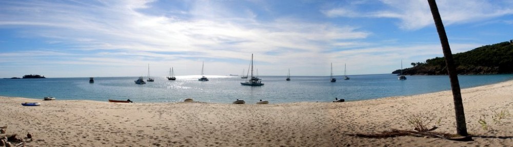
For those folks who like to stay on the beach, try exploring between the central sand dunes to find the tranquil cool forest, smelling the Native Frangipani if in season. This is different to the Frangipani dubbed the ‘Percy island Frangipani’ by the Society for Growing Australian in 1989 which is on the West Bay to Homestead track above the Aframe area lining the road for 1km.
The entrance to this beautiful forest is at the back of the sand-dunes near the centre of Whites Beach and is hidden between the dunes It is found by walking between the dunes lined with windblown Casurinas (stunted by the gale force SE winds) and into the more protected area behind the dunes which grows wonderful Paperbark trees.
Continue walking up the sandy seasonal creek to enjoy a refreshing change from the beach. The creek, when flowing, can offer sandy bottom pools to play in, prepared to be nibbled by yabbies!. This area was reputedly settled by the Kanaka trader, Capt. Cook Till in 1850s when he had a settlement of Islanders and Tories Strait peoples. These folk were taken to Mackay and Townsville for work on the Cane Fields. ( We acknowledge the suffering of these people and their ancestors, who were often forcibly removed from their homes, for trade by Kanaka Traders)
For more History of Captain Cook Till, please take the time to read the fascinating article by his family in www.thecoatsal passage.com
The creek bed ends at a rocky cliff with seasonally flowing waterfall which leads to the grassy hills above the Whites Bay towards the site of the potential airfield. Upon finding the track follow left to the Mt. Armitage – Whites Bay turn off with possibility of continuing the 1Km over Weather Station Hill to the Homestead.